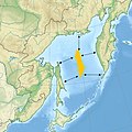
Gepokan:Peanut Hole.jpg

Ukuran ni terawangan: 600 × 600 piksel Resolusi laènnya: 240 × 240 piksel | 480 × 480 piksel | 643 × 643 piksel.
Gepokan asli (643 × 643 piksel, ukuran berekas: 102 KB, jenis MIME: image/jpeg)
Riwayat gepokan
Klik di tangga/waktu bakal ndeleng berekas sepagémana nongol tu waktu.
| Tanggal/Waktu | Longokan | Delokan | Pemaké | Sautan | |
|---|---|---|---|---|---|
| nyang paling baru | 4 Désèmber 2018 23.00 |  | 643 × 643 (102 KB) | Xfigpower | better localisation Source : https://digital.law.washington.edu/dspace-law/bitstream/handle/1773.1/944/4PacRimLPolyJ443.pdf?sequence=1 + file:File:Relief_Map_of_Far_Eastern_Federal_District.jpg |
| 17 Juli 2017 09.10 |  | 275 × 350 (14 KB) | Daylen | Transferred from en.wikipedia: see original upload log above |
Pemakéan gepokan
Ni halaman maké ni berekas:
Pemakéan gepokan kabèhan
Ni laèn wiki maké ni berekas:
- Pemakéan di az.wikipedia.org
- Pemakéan di bn.wikipedia.org
- Pemakéan di ca.wikipedia.org
- Pemakéan di de.wikipedia.org
- Pemakéan di en.wikipedia.org
- Pemakéan di es.wikipedia.org
- Pemakéan di fr.wikipedia.org
- Enclave de haute mer dans la mer d'Okhotsk
- Wikipédia:Statistiques des anecdotes de la page d'accueil/Visibilité des anecdotes (2022)
- Discussion:Enclave de haute mer dans la mer d'Okhotsk
- Discussion:Enclave de haute mer dans la mer d'Okhotsk/LSV 21706
- Wikipédia:Statistiques des anecdotes de la page d'accueil/Visibilité des anecdotes (2022)/2022 12
- Projet:Aide et accueil/Twitter/Tweets/archives/décembre 2022
- Wikipédia:Le saviez-vous ?/Archives/2022
- Pemakéan di he.wikipedia.org
- Pemakéan di id.wikipedia.org
- Pemakéan di it.wikipedia.org
- Pemakéan di ja.wikipedia.org
- Pemakéan di ru.wikipedia.org
- Pemakéan di tr.wikipedia.org
- Pemakéan di uk.wikipedia.org
- Pemakéan di uz.wikipedia.org
- Pemakéan di www.wikidata.org
- Pemakéan di zh.wikipedia.org

